The use of FME at Médecins Sans Frontières
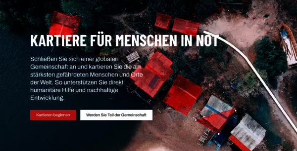 Humanitarian OpenStreetMap Team | GIS experts need base maps to be able to provide high-quality analyses of areas affected by humanitarian crises. The Missing Maps project helps with this.
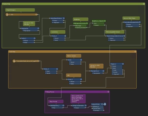 © MSF & SAFE (FME 2022) | Part of a multi-stage FME process to provide satellite imagery for Missing Maps projects.
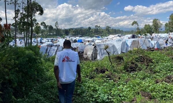 © Michael Neuman/MSF | Refugee camps around Goma
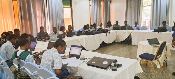 MSF | Goma University students volunteer to help map refugee camps such as Rusayo III
The independent aid organisation Médecins Sans Frontières creates fair access to vital medicines, provides emergency medical aid in the event of war, flight and natural disasters and makes humanitarian crises visible. Geodata plays an important role in this.
Médecins Sans Frontières was founded in 1971 and is now active in over 70 countries. The independent organisation for emergency medical aid supports people affected by conflicts, epidemics, natural disasters and other humanitarian crises who have no access to medical care.
In addition to impartiality, transparency and neutrality in its actions, highlighting grievances is a central principle in every mission of the organisation. However, relevant geodata is also essential for the planning of missions, as Leslie Jessen reported in a very interesting presentation at the axmann live 2024 event. She is part of the GIS team within the Médecins Sans Frontières organisation.
(Geo)data for documentation and planning
Data - especially geodata - is crucial for relief operations as it provides accurate information about affected areas. It helps first responders to make quick and efficient decisions, reach the right places and optimise the distribution of resources. Without accurate maps, important information is missing, which can severely hamper rescue and relief efforts.
The GIS experts within MSF support operations worldwide. The visualisation and analysis of geospatial data enables a better understanding of the context and facilitates the planning, implementation and monitoring of activities as well as reporting. This promotes informed decision-making both for aid projects and in acute crisis situations.
The GIS team often works with open and freely available data. This data is researched and, where possible, transformed in automated processes such as FME and made available to the teams on site. Data verification and quality control are also among the tasks of the data experts.
Project ‘Missing Maps’
In her presentation, Leslie Jessen gave a vivid account of an example project: A conflict in the DRC (Democratic Republic of Congo) has been forcing people to leave their homes for years. Several camps were set up on the outskirts of Goma where people found refuge. In February 2024, this camp was already home to an incredible 95,000 people and the numbers continue to rise. The people urgently need shelter, food, sanitary facilities and water. The problem is that many affected locations are missing from freely accessible maps, depriving first responders of important information.
‘Missing Maps’ is an open project where anyone can help map such areas to support humanitarian organisations: Volunteers digitise satellite images in the Humanitarian OpenStreetMap Tasking Manager, users on the ground add local details such as neighbourhoods or street names and humanitarian organisations can subsequently use these maps for their work. This data is crucial for providing aid quickly and planning the supply of clean water efficiently, for example.

© MSF, OSM Contributors, Missing Maps | Mapping Projekt for Rusayo III in 2024
This before and after comparison of a mapathon for Rusayo III, on the outskirts of Goma, shows the progress that is so important for aid organisations. In the meantime, the map has continued to grow - you can track the current status here: Rusayo 3 | OpenStreetMap
Just recently, Leslie Jessen used FME again as the basis for image processing for another Goma Mapathon.
With the Humanitarian OpenStreetMap Tasking Manager you can find a similar project at any time and map it at the same time: https://tasks.hotosm.org/.


